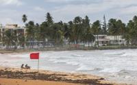
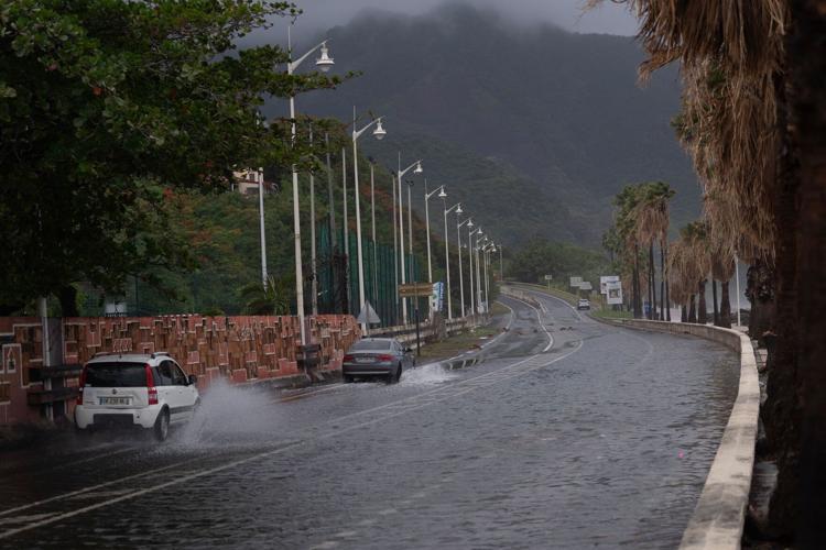
(CNN) — Hurricane Ernesto continued to unload flooding rainfall on Puerto Rico as it pulled away from the island Wednesday afternoon after its strong winds knocked out power to hundreds of thousands there and in the Virgin Islands.
The Category 1 hurricane had maximum sustained winds of 75 mph as of 2 p.m. EDT, according to the National Hurricane Center. Its center was more than 200 miles northwest of San Juan, Puerto Rico, Wednesday afternoon after passing over the Virgin Islands on Tuesday and then sidestepping Puerto Rico.
Strong winds extended far from its center and gusted in excess of 74 mph – hurricane-strength – in Puerto Rico and the US Virgin Islands.
As a result, more than 700,000 customers in Puerto Rico – half of all customers on the island – were without power Wednesday, according to LUMA Energy, the private company that operates the transmission and distribution of power in Puerto Rico. The number of outages doubled in just a few hours Wednesday morning.
In the US Virgin Islands, more than 46,000 customers were without power, which is about 92% of the island’s tracked customers, according to PowerOutage.us.
Nearly a half a foot of rain had fallen so far in Puerto Rico and the storm’s trailing bands of storms continued to unload it Wednesday afternoon, causing flash flooding — especially in the eastern and southern parts of Puerto Rico and in the Virgin Islands.
Multiple flash flood warnings were still in effect Wednesday afternoon for Puerto Rico.
Intense rainfall and flooding caused several rivers to flood in Puerto Rico and interrupted water filtration processes at a number of water processing plants to varying degrees, according to the island’s water authority.
These interruptions left more than 120,000 water customers – about 10% of total customers – without drinking water early Wednesday afternoon, according to the island’s emergency portal system.
Ernesto will make its way into open Atlantic waters later Wednesday where it is eventually expected to strengthen into a major hurricane, but its force will still be felt across parts of the Caribbean through much of the day.
Along Puerto Rico’s eastern coastline, storm surge raised water levels by 1 to 3 feet early Wednesday. Life-threatening swells and rip tides could prove dangerous for anyone in the water through the weekend.
Ahead of the storm, Puerto Rico Gov. Pedro Pierluisi mobilized the National Guard and urged people to shelter in their homes. Across the island, public schools are closed and nearly 80 shelters have been opened.
Residents were also warned to brace for widespread power outages as the island’s fragile and outdated electrical grid is still being repaired after it was crippled by Hurricane Maria in 2017.
Power outages are a familiar frustration among Puerto Ricans, many of whom have witnessed painstakingly slow efforts to modernize an electrical grid that remains highly vulnerable to natural disasters.
LUMA Energy said it has mobilized crews across the islands to respond to outages. And LUMA’s president, Juan Saca, urged people to report blackouts, noting the utility may not be aware of them all.
“Puerto Rico’s electrical system is not sufficiently modernized to detect power outages,” Saca said Tuesday, The Associated Press reported.
Where Ernesto is headed next
Ernesto will begin curving gradually to the north on Wednesday, bringing it away from the Caribbean and into open Atlantic waters, where it is expected to strengthen further.
Ernesto will become a powerful Category 3 major hurricane late this week and could retain that strength or be a strong Category 2 hurricane as it passes near Bermuda this weekend. How significant of a blow the storm will deliver to Bermuda depends on how close it gets to the tiny island, which is a third of the size of Washington, DC.
Bermuda will record stronger rain and wind impacts if the hurricane passes just west of the island as currently forecast. The island could be spared from more intense impacts if Ernesto passes to its east.
Ernesto’s strength will be fueled by very warm ocean water, a consequence of global temperature rise from fossil fuel pollution, and minimal storm-disrupting upper level winds.
Ernesto will have wide-reaching impacts later this week and this weekend despite a track somewhere over the open Atlantic.
The storm will churn up seas hundreds of miles away and could create dangerous rip currents for the US East Coast, the Bahamas and parts of the Caribbean into early next week.
More tropical trouble ahead?
Aside from Ernesto, no tropical systems are currently expected in the Atlantic into at least early next week.
This small break in new development won’t last long.
The chances for another hurricane will ramp up again later in August and persist through at least early September, according to the Climate Prediction Center.
Mid-August to about mid-October is hurricane season’s most active period, so the predicted ramp-up certainly checks out.
But tropical activity in the Atlantic is already pacing ahead of average. The basin typically doesn’t have its fifth named storm until late August or its third hurricane until early September.
Both have already occurred in what’s expected to end up as a very busy season.
CNN’s Ella Nilsen and Amanda Musa contributed to this report.
The-CNN-Wire
™ & © 2024 Cable News Network, Inc., a Warner Bros. Discovery Company. All rights reserved.


